Hikes Near Port Alberni
Imagine there was a search engine tool specifically for hikes. Maybe you’d select “waterfall”, or perhaps “beach front”. More criteria might be “old growth forests”, “viewpoint”, or even a unique feature like “suspension bridge”. If you were searching in the Port Alberni Valley, you’d be checking every box and getting all of the results I got to experience recently on my adventure with ZenSeekers.
Hikes Near Port Alberni
The night before my day of hiking, the ZenSeekers crew met up with a team of locals at at Twin City Brewing, including our guide for the morning, Sandy McRuer. When it was announced that he’d be taking us to Gracie’s Lookout just after sunrise, smiles lit up the room – we were in for a treat.
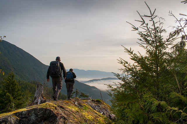
1. Gracie’s Lookout
Distance from Port Alberni town centre: 32km
Hiking distance from parking: 10-15 minutes, gradually uphill.
Details: Park in a pullout on the side of the road where you’ll see a wide trailhead on the east side of Mount Anderson that almost looks like an overgrown driveway. You’ll come to a clearing where the path levels off and to the north is a rocky plateau that will reveal a panoramic view of Sproat Lake and the entire Alberni Valley.
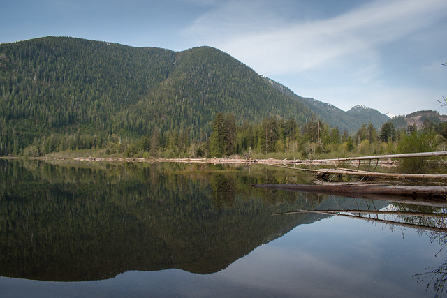
2. Nahmint Lake Recreation Area
Distance from Port Alberni town centre: 37.6km
Hiking distance: 500m to explore the campground and beach area
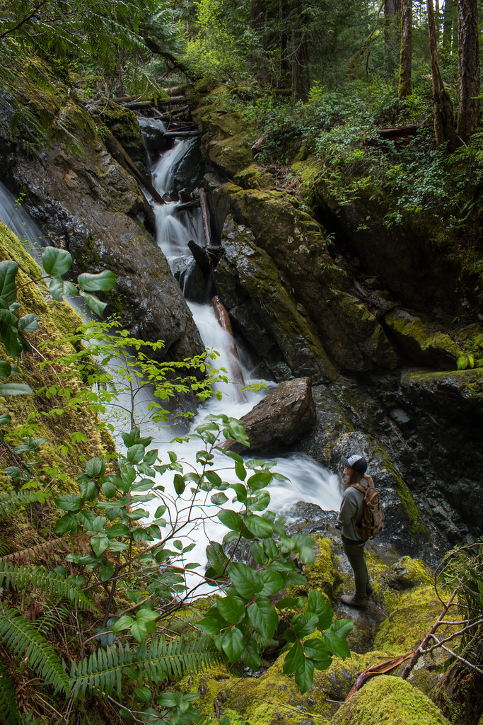
Details: Located across the Alberni inlet from Port Alberni, it features waterfalls, old growth trees, and a pristine mountain lake. This is a provincial park campground so there are facilities including walk-in and drive-in camping. Follow a trail along the creek to get to the waterfalls, about 250m from the lakefront.
3. Fossli Provincial Park
Distance from Port Alberni town centre: 16.6km
Hiking distance: 2.5km
Details: The first stretch is a gravel path down to the suspension bridge. Over the bridge you’ll come down to creek-level with a flat grove of old growth maples forming a lush green archway. The marked trail leads to a picnic area along the Stirling Arm of the south side of Sproat Lake. The whole distance is about a 2.5km, with an elevation loss/gain of about 60m if you do a loop.
Discover all of these locations and more by reading my full article over on ZenSeekers »
If You Go
- Search #ExplorePortAlberni for more inspiration. Be sure to tag #ExplorePortAlberni while exploring the region as you could be featured on our social media channels!
- Start planning your adventures in Port Alberni at Alberni Valley Tourism.
- Start exploring your Port Alberni region options with Destination BC.
- Find out more at the City of Port Alberni’s website.
- Read more about hiking in the Alberni Valley on ZenSeekers.