Metro Vancouver Trails: St Mark’s Summit
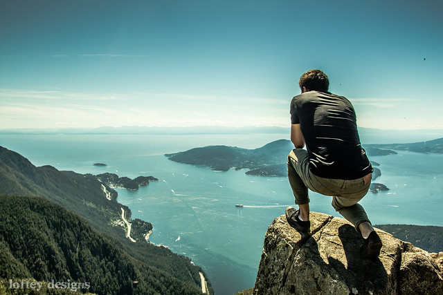
If your Instagram feed was filled with contented hikers posing for glorious photos at the peak of a trail with beautiful views of islands and waterways below, chances are they attacked either Quarry Rock in North Vancouver or St Mark’s Summit in West Vancouver. The latter is a more intermediate hike and is a part of a longer trail network that can be traversed in sections.
Just as some Lynn Valley and Grouse Mountain hikes are a part of the longer Baden Powell Trail (that spans from Deep Cove to Eagle Bluff) on the North Shore, St Mark’s Summit is a part of the Howe Sound Crest Trail (from Cypress Park, up past the famous Lions, to just south of Porteau Cove).
St Mark’s Summit
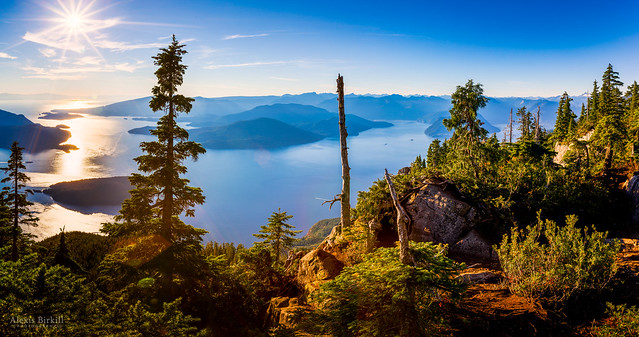
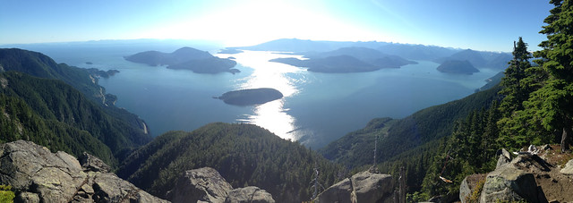
The hike to St Mark’s Summit is mainly open July to October and it leads to panoramic views of Howe Sound as you climb around the north west side of West Vancouver just north east of Horseshoe Bay, from Cypress Bowl. It’s step 2 in an 11 step Howe Sound Crest Trail, and is best suited for a clear weekend afternoon when you have about 4-5 hours to make the trek.
About the Hike
Rating: Intermediate
Distance: 11km (round trip)
Time Needed: 5 hours
Dog Friendly: Yes
Step 1: Trailhead to Strachan Meadows
Make your way by car to the Cypress Mountain ski area parking lot where you will park and head out for the day. Be sure to pack out what you pack in and bring plenty of water to stay hydrated. This first section is 2.64km and according to the Cypress Provincial Park guide, it will take about 45 minutes. “This first section offers good photo opportunities at Lions View Lookout. A short side trail to the west leads tot he Bowen Island Lookout and provides a glimpse of Howe Sound.”
Step 2: Strachan Meadows to St Mark’s Summit
This portion is +2.85km and approximately 1 hour 15 mins. The trail climbs 275m to the summit of St Mark’s Mountain. There is a short jaunt to the west where you can find an expansive view of Howe Sound.
At this point you have ventured out about 2 hours so looping back, it’s a good 4-5 hour hike depending on your pace and how many selfies are required — I would imagine many, since it’s such a phenomenal area!
The full Howe Sound Crest Trail (28km, 14-15 hours) continues to Unnecessary Mountain, the base of the West Lion, James Peak, Harvey Creek Saddle, Magnesia Meadows, Brunswick Mountain Trail, Brunswick Lake, Deeks Lake, and an outlet along Highway 99.
Its accessibility, proximity to Downtown, and high reward (views) make it an extremely popular hike. My friend Tanya has done it several times and I asked her what makes her return to this trail in particular: “It is spectacular. From the summit it feels like you are sitting on top of the world.” She says it always takes her 5 hours to complete as 30 minutes is usually spent resting and taking photos at the top.
“It was even pretty good in the rain, a bit of drizzle, because it’s less crowded and has a mystic feeling in the fog.” Without much rain this summer, Tanya told me that the creeks are dried up along the hike so it really is important to bring enough water with you during our drought.
Resources: Outdoor Vancouver, Vancouver Trails, Club Tread. Always prepare for the elements, stay hydrated, and let friends/family know when you’re going out on a hike.


